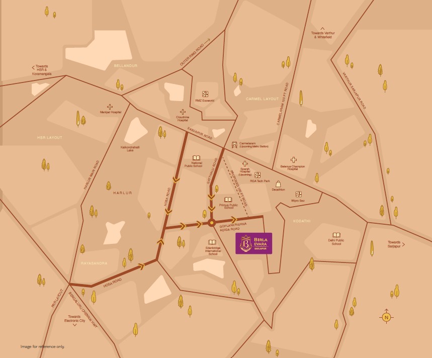
Birla Evara is ideally located at Sarjapur Road, East Bangalore. The exact location is SY. NO. 64/1, 64/2, 65/3, 68/3 & 68/4 at Kodathi Village, Varthur Hobli, Bengaluru East Taluk, Bengaluru East, Bengaluru Urban, Karnataka – 560035. The project is accessible via Gopala Krishna Adiga Road.
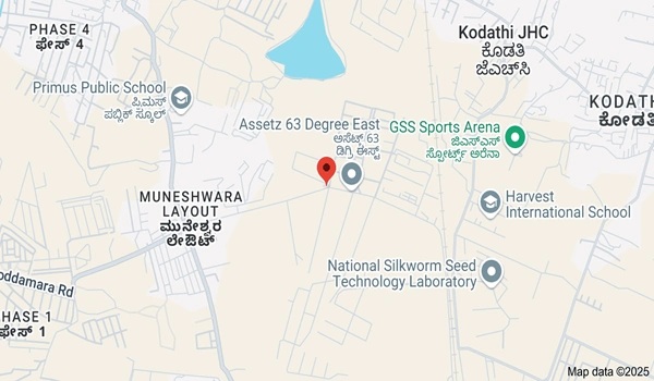
The project is close to Bengaluru Technological Institute and opposite the Assetz 63 Degree East apartment project. The locality has good access to key areas like HSR Layout, Electronic City, Varthur Marathahalli, and Whitefield.
Location is an important factor when considering a real estate investment. Sarjapur is a prime neighborhood in the eastern part of the city. The area is well-connected to other parts of the city via major roads like
Outer Ring Road
Chandapura – Dommasandra Road
Sarjapur – Marathahalli Road
NH 44
Harlur Road
Kodathi Road
Address
Birla Evara’s address is Sy. No. 64/1, 64/2, 65/3, 68/3 & 68/4 at Kodathi Village, Varthur Hobli, Bengaluru East Taluk, Bengaluru East, Bengaluru Urban, Karnataka – 560035. In location map it is mentioned as VPP3+36X Bengaluru, Karnataka, India.
Connectivity
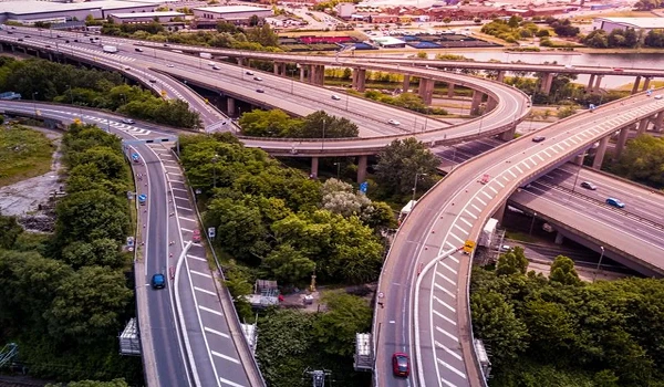
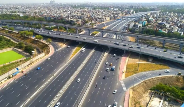
One of the most important factors in assessing a property’s worth is connectivity. The site is a popular one because it is easily connected to main roadways, public transportation systems, and basic services. High rental yields and maximum profitability are typically seen in those areas.
Chikkajala – 7.3 km
Devanahalli – 10.5 km
Bagalur – 12 km
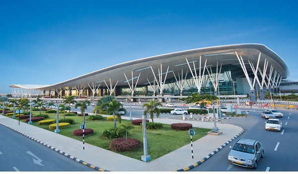
Airport Connectivity
The project location provides effortless access to the Bangalore International Airport via NH 75 and NH 44. It can be reached within 90 minutes.
Kempegowda International Airport – 53.6 km
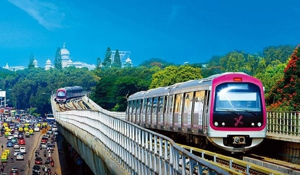
Metro Connectivity
The upcoming Namma Metro Red Line will enhance connectivity of the locality. This 36.59-km corridor will link Bengaluru’s important IT corridors, Sarjapur in the southeast and Hebbal in the north. The project location also provides easy access to major metro stations in Yellow Line metro.
Nearby Metro Stations:
Kodathi Gate metro station (Red line) – 2.5 km
Singsandra metro station (Yellow Line) – 7.9 km
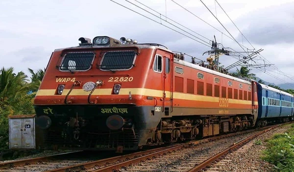
Railway Connectivity
The project location on Sarjapur Road is well-connected to the major train stations in the city. It is beneficial for travelling inside and outside the state in a cost-effective way.
Nearby Railway Stations:
Karmelram Railway Station – 5.6 km
Bellandur Railway Station – 9.2 km
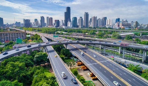
Road Connectivity
The project location provides simple access to major city bus stops, which is especially beneficial for working professionals who need to travel daily.
Nearby bus stops:
Chikkanayakanahalli Dinne Bus stop –600 m
Primus School bus stop – 1.1 km
Gattahalli bus stop – 2.5 km
Places to visit near Birla Evara
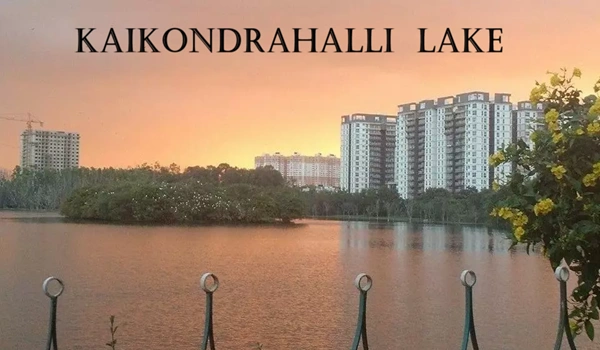
1. Kaikondrahalli Lake - 6.8 km
Kaikondrahalli Lake spread over 48 acres on Sarjapur Road, is home to up to 70 species of migratory birds. For a lovely walk around the lake perimeter, the pathway is just perfect for morning persons. A variety of tall and short trees surround the lake, and its entrance has an enormous ficus tree that attracts many birds.
In the centre of the water body, there is a small island and a wooded area at one corner of the lake’s bank. The lake is fantastic all year round, with numerous birds and insects each season, showcasing Bengaluru’s rich urban bio-diversity.
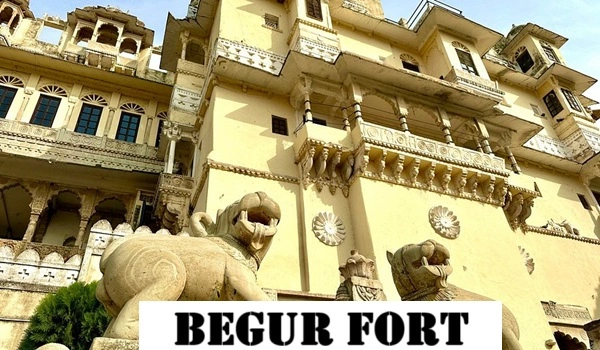
2. Begur Fort – 11.7 km
Over 1000 years old, Begur Fort and the Nageshwara temple lie in between Bannerghatta and Hosur Road. The fort is 3km off the more popular 1200-year-old Naganantheshwara (Nageshwara) temple with classic references to Chola architecture and art. The fort walls encircle a temple, some old houses, and a couple of non-descript structures of antiquity.
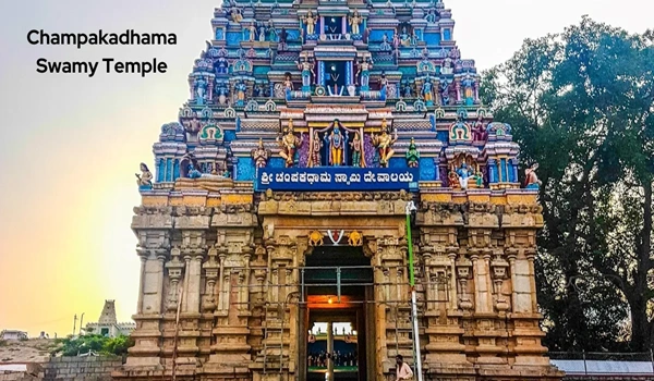
3. Sri Champakadhama Swamy temple – 22.2 km
Sri Champakadhama Swamy temple, also known as the Lakshmi Narasimha temple, is devoted to Lord Vishnu and Ma Lakshmi. The deity is referred to as Sri Chambakadhaswamy because it is customary to offer the Champak flower (Sapinge flower) to the Lord. The Suvarnamukhi pond, situated approximately 2 km from the temple, is also believed to have medicinal properties.
The 12th century is when the temple was built. The temple construction, constructed in 1257 AD during the Hoysala period and then expanded upon by the Vijayanagara dynasty, is shown by inscriptions discovered here.
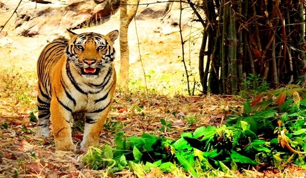
4. Bannerghatta National Park – 26.1 km
Established in 1970, Bannerghatta National Park was designated as a national park in 1974. A tiny section of the park was transformed into the Bannerghatta Biological Park, a zoological garden, in 2002. In addition to being a place for trekking and hiking, the park has historic temples for worship.
Six rural settlements are encased in three sizable enclosures for the purpose of raising cattle and sheep within the national park region. The explorers can see a variety of species in this park. For safaris and international tourists, this park provides a guided bus tour that travels the entire 6 km of safari routes.
5. Turahalli Forest – 27.3 km
Bangalore’s Turahalli Forest is the biggest of its kind. Turahalli offers 590 acres of space that may be used for hiking, biking, and rock climbing, so people can enjoy the great outdoors without ever leaving the city. There are numerous branch paths that lead to different locations along the main trail, which is a 3-mile loop. These consist of a symmetric forest, a Shani temple, and a mountaintop with deserted houses.
The British built roomy bungalows and exquisite gardens because they were drawn to the region’s climate. Nandi Hills was successfully turned into a quaint hill station. The 60-meter cliff known as Tippu’s Drop offers stunning vistas. Those who enjoy adventure sports can attempt parasailing. The Yoga Nandeeshwara temple on the hill is nearby.
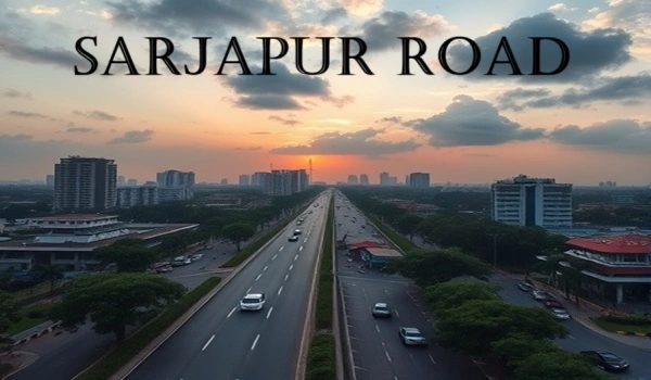
Sarjapur Road
Sarjapur is located between two IT parks and popular neighborhoods like Whitefield and Electronic City. The area has seen the greatest surge in real estate construction and is expanding quickly. The emerging IT hubs, and start-up companies continue to grow steadily in several of the region’s SEZ developments. Whitefield, Electronic City, Outer Ring Road, Marthahalli, and Koramangala are all easily accessible from this area.
Sarjapur Road is renowned for its many malls, facilities, venues, and breathtaking scenery. This is a popular choice among young professionals because of the high-end facilities and the proximity to the many well-regarded international schools. There are a number of hospitals in and around locality to seek treatment for emergencies. The upcoming Peripheral Ring Road (PRR) and Satellite Town Ring Road (STRR) are expected to ease traffic congestion.
Sarjapur Road and its connectivity
Airport Connectivity
Sarjapur Road provides easy access to Kempegowda International Airport in Devanahalli. Travellers can select easy routes to get to the airport. Important routes, including NH-44, NH-75, and Bellary Road, easily connect the locality with airport.
Road Connectivity
Sarjapur Road is easily connected to the major connecting roads of the Bangalore city.
Interchange stations in Namma Metro Blue Line are:
Outer Ring Road (ORR):Connects Sarjapur Road to key IT hubs like Bellandur, Marathahalli, Whitefield, and Hebbal.
Sarjapur-Attibele Road:Connects Sarjapur to Attibele, a key junction near Hosur Road. It provides access industrial zones near Hosur.
Sarjapur-Bagalur Road:Links Sarjapur to Bagalur and Hosur, offering an alternative route to Tamil Nadu.
NH 44 (Hosur Road):Connects Sarjapur Road to Electronic City, Bommasandra, and Silk Board Junction.
Varthur Road (Whitefield Main Road):Provides a direct route to Whitefield, ITPL, and Hoodi.
NH 648 (Peripheral Ring Road – PRR) [Upcoming]:It will improve connectivity between Tumkur Road, Hosur Road, and Old Madras Road.
Metro Connectivity
The Red Line of the Bangalore Metro (Namma Metro) is an upcoming corridor in Phase 3 of metro expansion. It is proposed to run from Hebbal to Sarjapur. It will improve connectivity between Southeast and North Bangalore, covering major residential and commercial hubs.
Major interchange station: Hebbal is considered a key interchange point, connecting the Red Line with the Blue Line and the Orange Line.
Other interchange stations: Agara and Iblur, also offer connections to the Blue Line.
Top schools near Birla Evara
Eden Bridge International School – 1.2 km
Harvest International School – 1.6 km
Sri Ravindra Bharati Global School – 2.5 km
GIG Inetrnational School – 3.6 km
Ryan International Academy – 3.9 km
Divine Providence School – 5.2 km
The Grandeur International School – 8.6 km
Best hospitals near Birla Evara
Belenus Champion Hospital – 5.7 km
Springleaf Hospital – 8.6 km
Kauvery Hospital Electronic City – 8.9 km
Marvel Multipseciality Hospital – 9.7 km
Greenview Hospital – 10.2 km
Spurthy Hospital – 11.3 km
Lifeacre Hospital – 14.5 km
Major IT parks near Birla Evara
RGA Tech Park – 5.1 km
Pritech Park – 7.5 km
Krishna tech Park – 7.7 km
Global Technology Park – 8.2 km
Prestige Tech Park – 8.9 km
Ozone Manay Tech Park – 9.1 km
Velankanni Tech Park – 10 km
Shopping Centres near Birla Evara
Centro Mall – 11 km
Central Mall – 12.7 km
Brookfield Mall – 17.1 km
Nexus Whitfield – 17.9 km
Virginia Mall – 18 km
Park Square Mall – 20.5 km
Phoenix Market City – 21. 5 km
Faqs - Frequently Asked Quetions
1. How far is the railway station from Birla Evara?
The nearest train station is the Karmelram Railway Station, which is 5.6 km from this project.
2. How far is the Airport from Birla Evara?
The airport is 53.4 km from this project, and it can be reached in 90 minutes.
3. Is it simple to get to the necessities from the project site?
The project’s location provides easy access to important educational institutions, medical facilities, retail malls, IT parks, and other necessities.
4. Is there good connectivity in the project?
The locality offers a good system of roads and flyovers, and the project offers good road connections. It has a strong rail system, and the planned metro will enhance transportation even more. There is a strong air network for business travellers, and the project is close to the airport.
5. Does the project location provide easy access to any IT or Tech parks?
The project location is well-connected to the city’s major IT and tech parks, some of which are RGA tech park, Prestige tech park, etc.